Features
- attach technical information to a post (ex. how long was your trip, how much did you totally climb, where from and where to, how hard do you think it has been, what kind of roads or trails did you encounter etc.);
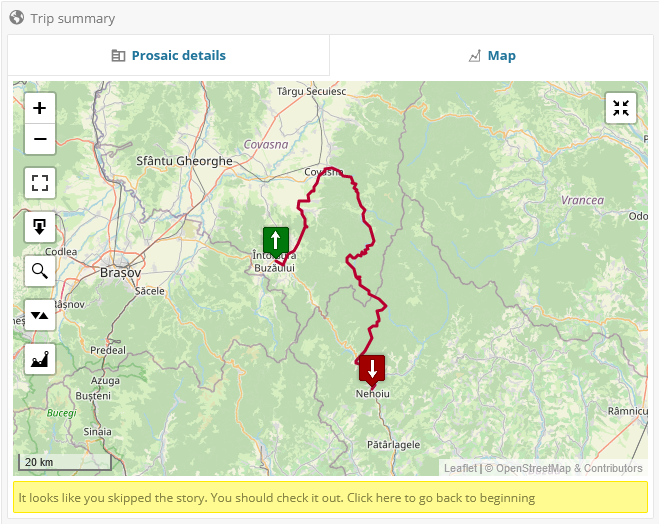
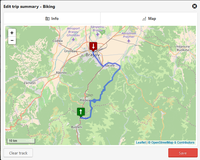
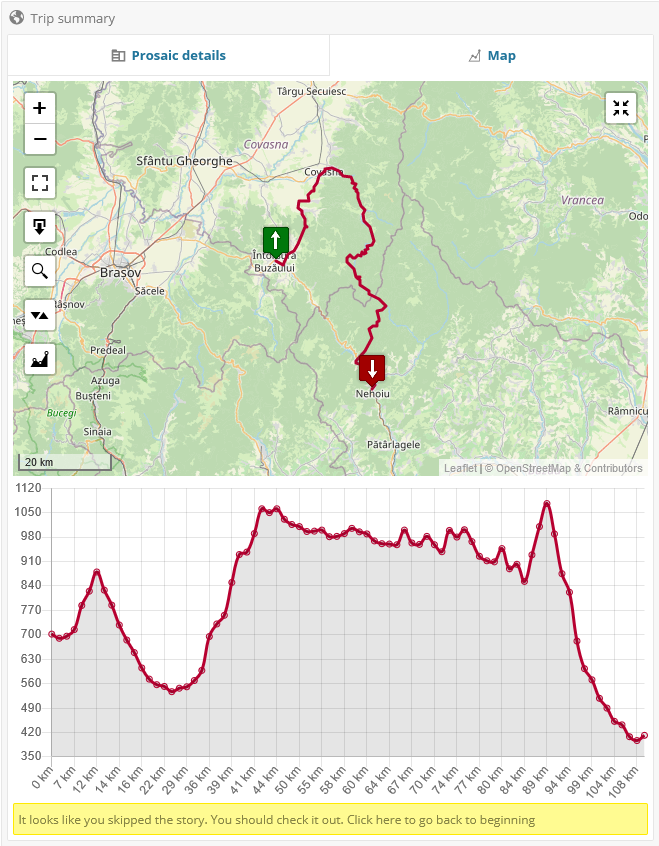
- attach GPS data to a post (GPX, GeoJSON and KML files are currently accepted as data sources) and display that track on a map;
- maintain rider’s log entries, while optionally specifying some of them as public;
- allows management of the look-up data used to populate the fields presented as single or multi-selection options list (ex.
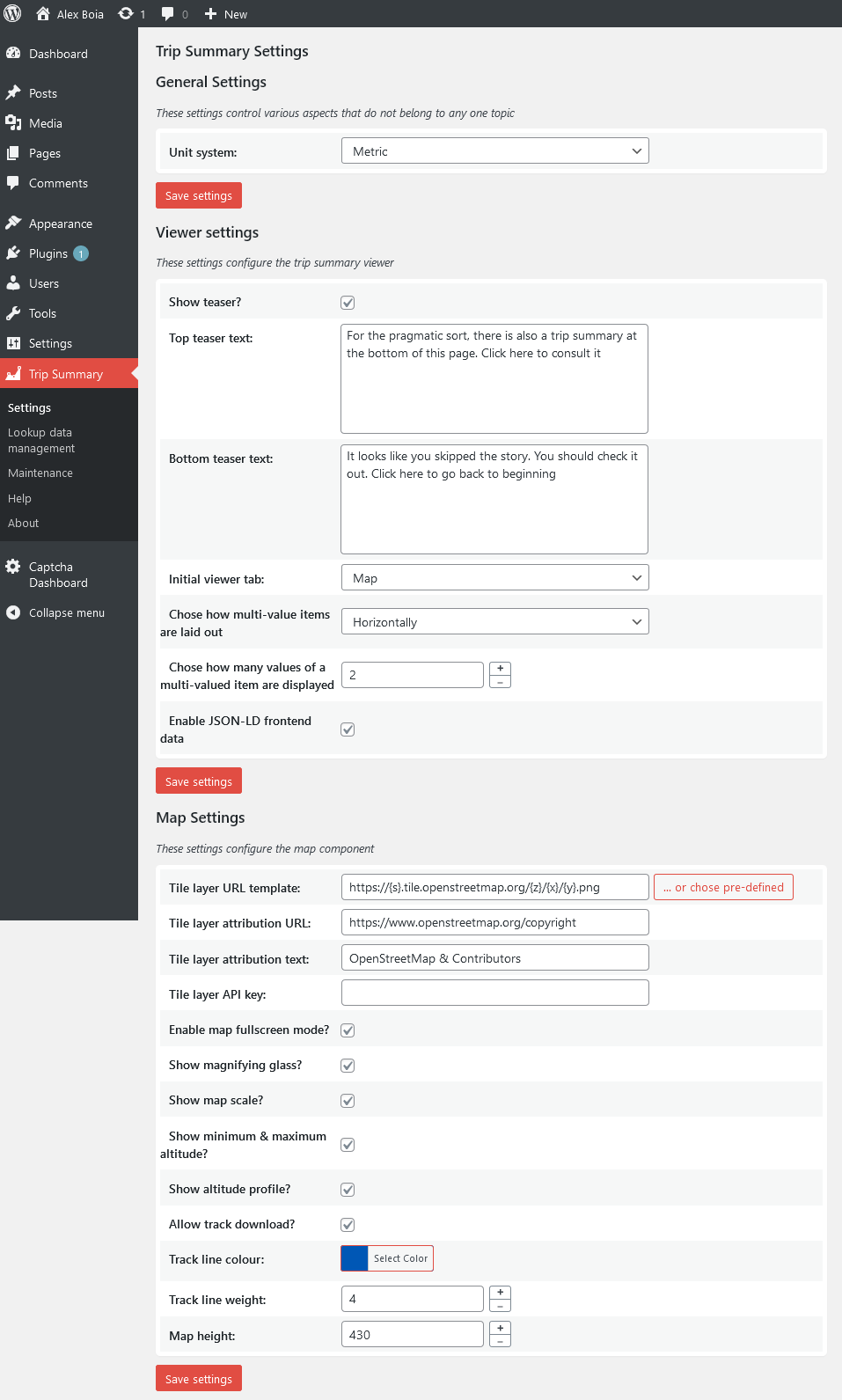
Difficulty Level,Open During Seasonsetc.); - allows customization of the map layer:
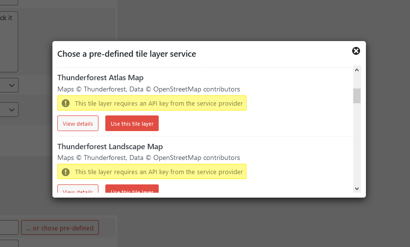
- map tile source (comes by default configured with OpenStreetMap);
- enabling/disabling of available map controls;
- customizing the visual representation of the track).
- allows customization of the measurement unit system used to represent various values (ex.
Total distance,Total climbetc.); - multi-language.
More details
This plug-in provides three basic features:
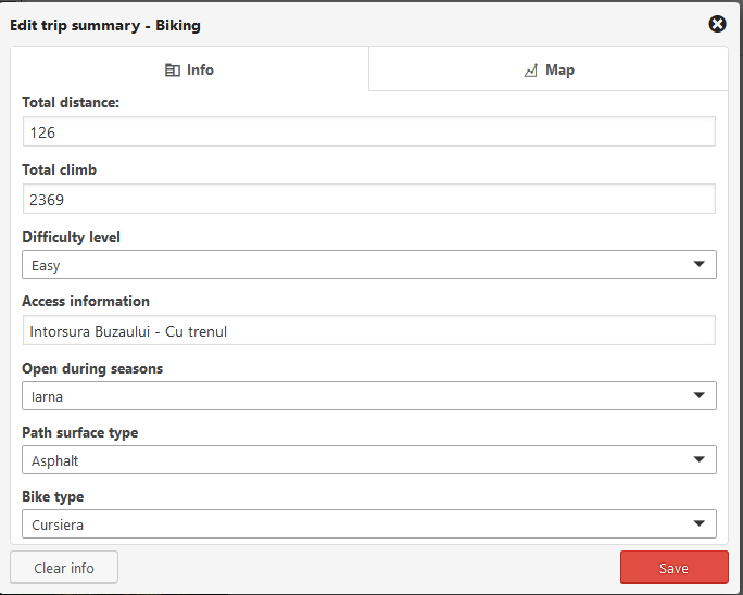
– allow some structured information to be filled in, according to a selected trip type;
– allow some GPS track to be uploaded and then rendered on a map;
– maintain rider’s log entries, while optionally specifying some of them as public.
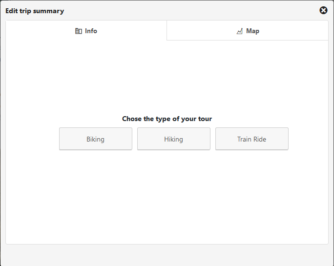
Structured information is supported for the following types of trips:
– Bike trips;
– Hiking trips;
– Train rides.
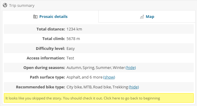
For bike trips the following fields are available:
– Total distance;
– Total climb;
– Difficulty level;
– Access information (how to get to the start point and return from the end point);
– Open during seasons;
– Path surface type (eg: dirt, asphalt, grass etc.);
– Recommended bike type (eg: MTB, road bike etc.).
For hiking trips the following fields are available:
– Total distance;
– Total climb;
– Difficulty level;
– Access information;
– Open during seasons;
– Path surface type;
– Route markers.
For train rides the following fields are available:
– Total distance;
– How many trains were exchanged;
– Line gauge (mm);
– Railroad operators used;
– Line status (closed, operational etc.);
– Whether the line is electrified or not;
– Line type.
Requirements
- PHP version 8.0.0 or greater (as of version 0.3.2);
- MySQL version 5.7 or greater (with spatial support);
- WordPress 6.0.0 or greater;
- libxml extension;
- SimpleXml extension;
- mysqli extension;
- mbstring – not strictly required, but recommended;
- zlib – not strictly required, but recommended.
Multi language
Available in English, Romanian, French and (since 0.3.2) German.
Helping out
- by contributing: head over tot he project’s GitHub page: https://github.com/alexboia/WP-Trip-Summary;
- by donating: https://ko-fi.com/alexandruboia;
- support my paid work: https://alexboia.gumroad.com/.